The Plan
Community support for Haslemere’s precious AONB woodland and meadows!
Community support for Haslemere’s precious AONB woodland and meadows!
The Neighbourhood Plan is now due for referendum Thursday 7 October 2021
details will follow when announced by Waverley.
details will follow when announced by Waverley.
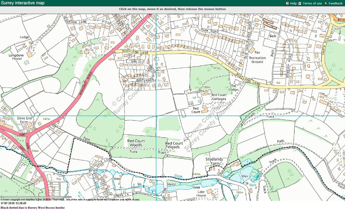
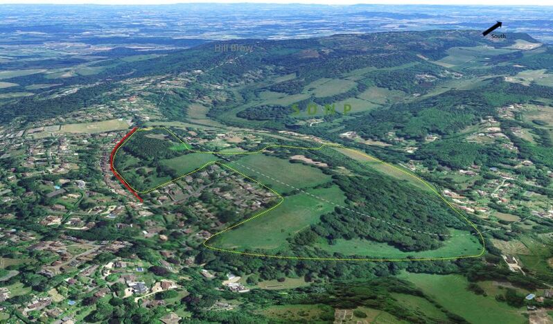 Aerial shot of Red Court - The RED Boundary position - where it should be. Why would anyone destroy this?
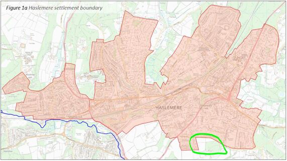
The Settlement Boundary (Passed by HTC Nov 28th 2109)
Great news for all the residents of Haslemere as the rural land around us should now have the additional protection it deserves. This is not a definitive block on development, but the first step to contain Haslemere and prevent urban sprawl. We have more work to do, but with a formal boundary now defined, planning permission for much large developments will be harder to obtain.
Last Thursday (28th), Haslemere Town Council voted by a large majority to keep the Settlement Boundary where it was originally mapped in the Neighbourhood Plan by Haslemere Vision and where 65% of the community wanted it plus 89% did not want large scale development outside the boundary.
Earlier in the year, several Councillors voted to redraw the Settlement Boundary specifically encompassing areas outside the current urban line surrounding Haslemere including Red
Court and Longdene. This meant our precious AONB, AGLV and green belt were open to developers to plough and concrete the rural areas which make Haslemere so beautiful.
Cllr Robini (also the Mayor) proposed a motion to formally assign a boundary line encasing the urban area. The motion was to adopt the revised Neighbourhood Plan with a formal Settlement boundary. Our newly elected Councillors, Cllr Barton(Ind), Cllr Ellis (Ind) and Cllr Weldon (Lib) supported the motion. A set of the last Council group who were re-elected decided to act against the community they support and voted against the motion. Many thanks to the large majority of councillors who supported the motion.
The final statement in the Neighbourhood Plan States:
"Haslemere Town and surrounding Villages do not have a formally recognised settlement boundary, although there is an informal boundary based on the existing built area as almost all other surrounding land has some form of protection (Green Belt, AONB, AGLV, Land owned by the Natural Trust and the Wealden Heath Special Protection Area).
Therefore to clarify the situation for future planning purposes the plan proposes a formal defined and recognised settlement boundary that maintains and contains the current urban boundary, to protect the character of the town and prevent unrestricted growth into the countryside."
Basically this will make planning of development outside this boundary very difficult. Red Court is naturally part of this protected area. The document will now be passed over for public consultation. This will hopefully be a quick process as the 7 years taken to prepare this plan must now be brought to a final conclusion. This will be adopted into the Local Plan supported by Waverley BC.
Cllr Paul Follows tweeted his support soon after the meeting Paul Follows (Lib) is standing as the local MP for the area in the December 2019 General Election.
ARCHIVE
What do we, as local residents, have our eyes on when it comes to voting for our next representative at Surrey County Council on May 6th?
The candidates are:
• Ged Hall (Cons)
• David Irwin (Lab)
• John Robini (Lib Dem)
While Planning Inspectors review LPP2 and Haslemere’s Neighbourhood Plan and Waverley considers Redwood’s planning submission to Waverley, HSRA suggests its members consider a non-political question:
Which candidates in the Surrey County Council May elections will be most likely to protect Haslemere’s unique countryside and protected AGLV and AONB?
To answer this question, it will be useful to know how your Town Councillors voted on allowing a large housing development on protected countryside at Red Court: this is how they voted on a planning application for this development at the Town Council Planning Committee on September 10th last year:
Voted AGAINST development on Red Court
Cllr Robini (Lib)
Cllr Lloyd (Green)
Cllr Barton (Ind - represents Haslemere South ward)
Cllr Weldon (Lib)
Cllr Keen (Lib)
Cllr Ellis (Ind - represents Haslemere South ward)
Voted FOR development on Red Court
Cllr Dear (Cons - represents Haslemere South ward)
Cllr Round (Cons)
Cllr Hewitt (Cons)
Abstained
Cllr Isherwood (Cons)
Cllr Cole (Lib)
It may also be relevant for you to understand the following facts:
Ged Hall
Mr Hall was contacted on March 26th, 2021 asking him to confirm his position on supporting the Neighbourhood Plan and protecting our green spaces from spaces from development. No response has been received; we will let you know when we receive an answer.
Mr Hall’s supporters include Cllr Dear, who represents us in the Haslemere South ward at town and borough level. Cllr Dear voted in favour of development on Red Court (see above) and also proposed (seconded by Cllr Odell) a vote to reject the Neighbourhood Plan’s protection of the AGLV land at Red Court- fortunately no other Councillor agreed with them!
David Irwin
We are in the process of trying to contact him to seek his views on the Neighbourhood Plan, the protection of our green spaces and the proposed housing development on Red Court. We will let you know when we receive a response.
Cllr John Robini
Cllr John Robini, current town Mayor has strongly supported the Neighbourhood Plan which following extensive public consultation seeks to protect AONB and our green spaces. As town councillor, Cllr Robini voted against the proposed plan to develop Red Court.
- Closed - Neighbourhood Plan Survey - Closed -
The deadline for responding to the Neighbourhood Plan survey is May 31, 2020.
Your comments are essential if we are to protect our local AONB/AGLV and prevent
unacceptable development destroying important wildlife habitats, green spaces and woodlands. Your responses will be taken into material consideration, so please give this matter some of your valuable time.
The survey is in four sections and we encourage all adults in your household to complete them, since every person’s input counts. This note sets out some points for your consideration.
You will see that the draft Neighbourhood Plan states that:
“65% of respondents, expressing an opinion in the Haslemere Vision Phase II consultation, wanted to ‘build as many houses as possible within settlements’ rather than on greenfield land. To achieve this aim, it will be necessary to prioritize brownfield sites within the built area before sites outside the built area, and to build at densities which maximise the contribution the sites make to the housing target. That means some strategic sites within Haslemere will need to be built at medium to high housing densities (above 45 dwellings per hectare or dph – see Glossary page 63) and some ‘windfall land efficient development’ will occur within the town.”
The Plan also states that it intends “to preserve areas of high landscape quality, in particular AONB/AGLV sites.”
As you respond to a number of the questions you may wish to add comments to make sure that these fundamental policies are not diluted unintentionally. Some key survey questions are worded somewhat ambiguously in that a simple positive answer could be interpreted as support for greater latitude to large-scale development on AONB/AGLV land which a respondent might not actually support. Some ambiguity is hard to avoid in these types of questionnaire, but you are invited to bear this in mind when completing the questionnaires.
HSRA believes the Neighbourhood Plan should reflect the community’s commitment to achieve the housing target by developing on brownfield, in-fill and land of lesser landscape or ecological value as a priority, without lowering the hurdles to development on greenfield AONB/AGLV. Indeed, the whole basis of a Neighbourhood Plan is to channel development in the right way overall, respecting the various policies, including density, affordable housing etc. whilst also taking into account the community’s strong wishes regarding the protection of its green spaces.
A detailed submission on behalf of HSRA is being prepared, in addition to members’ own responses to the consultation.
Finally, a few detailed points which we hope you will find helpful:
- Note that answers to questions H1.3, H 3, H4 and H 14.1 and H 14.2 could be misinterpreted as support for building on AONB/AGLV outside the settlement boundary, under the various rationales given (e.g. biodiversity off-sets etc.). While any of these conditions for a development may be positive in isolation, you may wish to qualify your answers. Ticking Yes, OK but without providing an additional comment could be taken to mean you agree that AONB/AGLV should be treated in the same way as brownfield, in-fill and existing built land, whether inside or outside the boundary settlement.
- Also note that question H1.1 asks whether you support the Housing policy with a Yes, OK or No click – and invites you to additionally provide views in the comments box. If you have comments to make, make sure you click your answer, and in addition click “How would you improve or alter this policy?” You will see that the bold circle seems not to register your earlier choice. Ignore this, and write your comments, making sure you say which of the three above answers you have given.
- With regard to policy H4, it is proposed that the community would not formally have to be consulted on any development of less than 50 dwellings, inside or outside the settlement boundary. While consultation may need to be proportionate from a costs perspective, HSRA’s view is that consultation should be required for smaller developments as well (say, of at least 10 dwellings outside pre-existing buildings).
The Neighbourhood Plan and its Summary you have been presented with are draft documents that will be revised and move to a final draft on the basis of this public consultation. The Plan will then go to Waverley Borough Council and an Independent Inspector for approval and then public referendum.
You can approve, object to, and comment on any aspect of the draft Plan, the Summary and
the questions.
https://www.haslemeretc.org/neighbourhood-plan.html
https://www.surveymonkey.co.uk/r/SZL5QTJ
(Please note that the comments here are prompts and observations for you to take into account, so please do not copy / paste these comments rather than putting your thoughts into your own words!)
Try to do all the surveys if you can. Survey 1 (Housing) is especially important.
Alternatively if you wish to make additional comments for consideration you can email them to [email protected] or [email protected]
If you want your previous survey to be superceded by the new survey you can do that by emailing [email protected] and ask to have your earlier survey removed. If you are just adding additional comments then the surveys do not need to be linked. [This last sentence is not v. clear – is it that you start a new survey to add comments just on questions you want to? Or do you need to ask them to re-open your previous survey to go in and add questions?]
This map is an extract from the Plan for illustration, but please use the link above for any information.
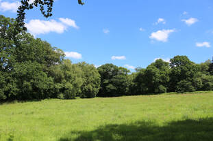 Saving your local AONB
Serious threat to Haslemere’s unique countryside:
Developers plan a gateway of urbanisation to South Downs National Park!
What’s all the fuss about?
Protecting the environment and wildlife – the so-called “extinction emergency” – is a critical priority for action at a global, national and local level. They are top of this generation’s agenda and our children’s. But Haslemere’s green spaces are being targeted on an unprecedented scale. The countryside that connects Haslemere to the Surrey Hills and South Downs National Park is under threat from developers. After the swathe of Haslemere’s land at Sturt Farm was approved for urbanisation, yet another Area of Outstanding Natural Beauty (AONB) is at risk, south of the High Street; a massive housing estate off the Midhurst Road and Scotland Lane, with close to 200 houses, is soon to be proposed for approval.
Why is it important?
There are some key reasons why this is so very important:
There are some key reasons why this is so very important:
 protected and rare Slow worm
1. Jeopardising wildlife. The land in question with plans to concrete is not only within Surrey Hills AONB, but is also protected as a Wealden Heath II SPA Zone. It is an irreplaceable natural community asset, home to vulnerable and endangered wildlife, a biodiversity habitat of wood and trees species. There are specific laws protecting this wildlife area which must be respected.
Protected in the UK under the Wildlife and Countryside Act, 1981. Priority Species under the UK Post-2010 Biodiversity Framework
Protected in the UK under the Wildlife and Countryside Act, 1981. Priority Species under the UK Post-2010 Biodiversity Framework
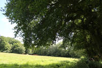 Our field under threat
2. Destroying landscape. We must not betray the vision for nature handed down from generation to generation of Haslemere residents and that we all enjoy. Haslemere’s forefather, Robert Hunter, had a vision to protect the surrounds of the town and founded the National Trust on our doorstep. Later, residents pooled their land and resources to extend the areas of National Trust land from Devil’s Punch Bowl, in the north, to Blackdown to the south, encircling the town with glorious protected areas of outstanding natural beauty. Do we want to allow that land to be ripped back from nature and given over to buildings and tarmac?
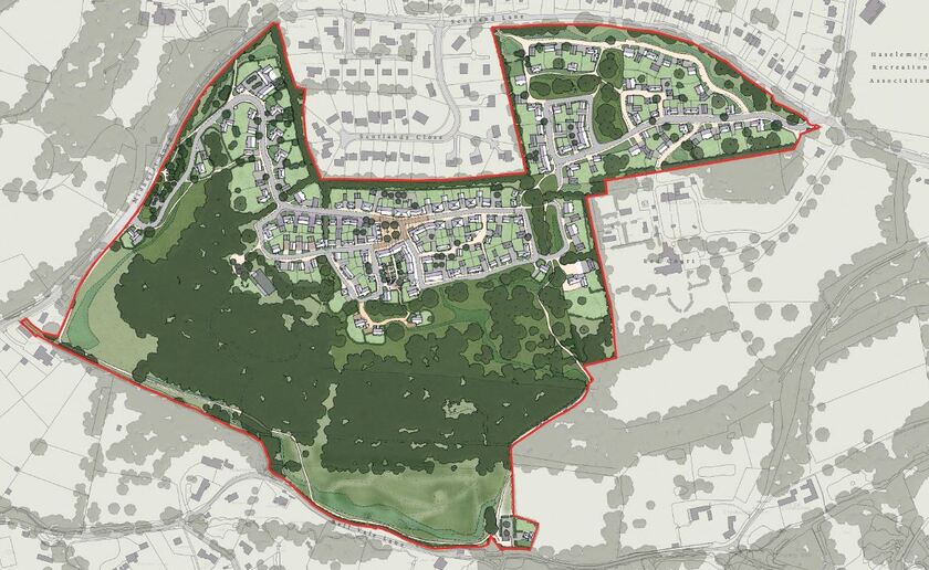
What is the developer up to - ?
Plan of the lost AONB and wildlife
Plan of the lost AONB and wildlife
What is HSRA’s position?
Haslemere South Residents Association (HSRA) was established in 2018 to bring the community together to preserve the amenities of South Haslemere and support its community. Currently, our number one priority is to inform the community of the events happening on any development on the green spaces around Haslemere, most importantly the current proposals on the former Red Court estate. We seek to unite the local residents and ensure our voice is heard by Waverley Borough Council, and by our local Haslemere Town Councillors.
HSRA fully endorses endowments and provision for the community, such as for the Scouts and schools, but we also believe that such arrangements should not come with strings attached, especially when they are the erosion of the essence of Haslemere and its surroundings. Redwood have made their ‘gift’ to the Scouts and school contingent on support for their large housing estate, and will only be ‘given’ if and when planning permission to build 180 houses is granted.
The developer has tried to use CPRE’s call for greater schoolchildren access to the countryside as a reason to lay concrete over 35 acres of that very countryside, conveniently ignoring the fact that CPRE has written to object to the development! In our view, there is absolutely nothing to stop any developer giving open access to its land to the Scouts and schoolchildren, if it truly cares about their needs.
When something sounds too good to be true, it usually is!

